


Yamuna Crosses 207 Meters in Delhi: 2025 Flood Alerts, Risks, and Evacuation Updates
 Yamuna Crosses 207 Meters in Delhi: 2025 Flood Alerts, Risks, and Evacuation Updates
Estimated reading time: 16 minutes
Thank you for reading this post, don't forget to subscribe!Yamuna Crosses 207 Meters in Delhi (2025): Flood Alerts, Rising Risks, and What Comes Next
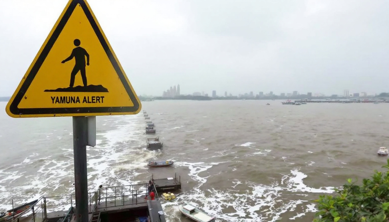
A thick gray sky covers Delhi as the Yamuna crawls higher, brushing past 207 meters yet again. With the river at its peak since 1963, fear runs through families living near its banks. The yellow alert now hangs over the city and its neighbors, warning of more rain, rising water, and new danger.
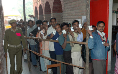
Residents from east, north, southeast, northeast, and central Delhi are packing what they can and heading to crowded relief camps, unsure what tomorrow holds. The sight of water licking at street corners, the hush broken by evacuation sirens, and the memory of past floods weigh heavily right now. This rare surge isn’t just a number on a ruler—it’s a signal that the flood season has come early and brought real risk to everyday life.
Current Flood Situation and Alerts
The Yamuna’s surge isn’t just news—it’s part of daily life now. Sirens sound in low-lying neighborhoods and the city’s rhythm shifts. Forecasters and water officials work around the clock as updates roll in every few hours. Delhi, NCR, and parts of the northern belt keep a close eye on a swollen river, weather bulletins, and shifting flood alerts.
IMD and CWC Warning Timeline
This season’s alert sequence has been rapid and unsettling, matching the river’s unpredictable rise. Here’s a clear look at how the warnings unfolded and what each alert meant for the city:
- 12:00 pm to 3:00 pm: The first yellow alert is announced by the India Meteorological Department (IMD). Cloud cover thickens, with moderate rain predicted. Water levels are rising quickly.
- 3:00 pm: The Central Water Commission (CWC) records the Yamuna at 207.09 meters. Officials shut the Old Railway Bridge (Loha Pul), and advisories warn people to stay away from vulnerable river banks and drains.
- 5:00 pm: Forecasts expect the next sharp rise. By 8:00 pm, CWC predicts the water might touch 207.40 meters, increasing the city’s risk.
- 8:00 pm: If the river crosses 207.40 meters, officials may upgrade the alert and intensify evacuations and emergency actions.
What do the alerts mean?
Below are the key official thresholds, as set by IMD and CWC. Each color brings greater urgency.
| Alert Level | Water Level (Meters) | What It Means |
|---|---|---|
| Yellow | 204.5 and above | Moderate risk; stay alert, avoid riverbanks |
| Orange | 205.33 and above | High risk; prepare for significant flooding |
| Red | 206 and above | Severe risk; evacuations, protect property |
The river’s current level far exceeds even the “red” threshold, showing just how serious the situation is. For the latest, see detailed analysis at Delhi Flood Alert: In 63 years, Yamuna has breached 207m only in four rainy seasons.
Officials have also flagged heavy rain for neighboring states: Jammu-Kashmir, Uttarakhand, Himachal, and Punjab. These warnings matter because rain upstream adds to the river in Delhi, swelling it further overnight.
Geographic Areas Under Alert
Flood alerts blanket the city’s most exposed zones and ripple across nearby NCR districts. The greatest danger follows the Yamuna’s bend, especially where the land dips and drainage falters.
- Delhi:
- East, Central, and Northeast Delhi see the worst flooding. Streets near the river, old city markets, and low-lying colonies are at highest risk.
- Relief camps fill up quickly, as over 10,000 residents leave homes for temporary shelters.
- Ghaziabad and Noida (Orange Alert):
- Major corridors along the river’s eastern edge and near drain outfalls face possible rapid water rise.
- Local authorities warn of blockages, flooded underpasses, and road closures.
- Gurgaon and Faridabad (Red Alert):
- With higher soil saturation and more intense rain, water collects quickly. Streets in newer housing clusters and older settlements both see waterlogging, forcing authorities to prep for more evacuations.
A simple overview of the district alerts:
| District/Area | Current Alert Level | Main Risks |
|---|---|---|
| Central / East Delhi | Yellow | Riverbank flooding, road closures |
| Ghaziabad / Noida | Orange | Heavy rain, drainage overflow |
| Gurgaon / Faridabad | Red | Rapid flooding, shelter activation |
You can track ongoing official action at Delhi-NCR Flood, Weather Today Live Updates.
Evacuation orders are in place for the lowest-lying areas, and some roads and railway lines have already closed. Relief workers move door to door, while local leaders monitor small drains and city outfalls. The crisis goes beyond Delhi—persistent rain and rising rivers also impact towns in north India, especially where the rainfall and river surge overlap.
If you live near the river or in a low zone, be ready to move. Authorities say to watch for new alerts every few hours as weather patterns keep changing. Stay connected with neighbors, and rely on trusted news and official advice as the river’s mood shifts again.
For up-to-the-minute river readings and latest alerts, visit Delhi Yamuna crosses danger mark; residents in low-lying areas shifted to safer locations.
Historical Context of Yamuna Levels
Understanding the current situation with the Yamuna crossing 207 meters requires looking back at history. This river’s high waters have shaped lives and landscapes in Delhi across decades. Each time the river approached or crossed this critical mark, it left a trail of damage, disruption, and community response. History repeats itself not as a story, but as a pattern—one we observe to learn and prepare better.
Past Floods and Their Aftermath
Since 1963, the Yamuna has crossed 207 meters only five times, with each event marking a serious challenge to the city. The floods of 1978 stand out as one of the most severe, with the river climbing to 207.49 meters. At that time, vast areas in Delhi submerged, forcing thousands to evacuate. Homes near the riverbanks were damaged, roads turned impassable, and recovery took months. Local governments struggled with delayed rescue and relief efforts, highlighting the need for better flood management.
Fast forward to more recent years:
- 2013 Floods: The river hit 207.32 meters. Delhi faced intense flooding in parts of the city, especially in low-lying colonies. Schools and public spaces closed, and relief camps filled quickly.
- 2023 Record: With a peak at 208.66 meters, the highest since the measurement began, it brought the river dangerously close to breaking the local embankments. Major evacuations took place. Emergency services pulled together faster, reflecting lessons learned from past floods.
The impact of these floods often goes beyond water levels. Displacement causes waves of disruption: businesses shuttered, transport halted, and public health strained by contaminated water. Yet, recovery through coordinated relief camps, medical aid, and infrastructure repair showed the city’s grit. Despite improvements, each crossing of the 207-meter mark renews these challenges, reminding Delhi of its fragile balance with the Yamuna.
For deeper insight into these events, you can refer to reports like the Delhi on alert as Yamuna likely to cross critical mark.
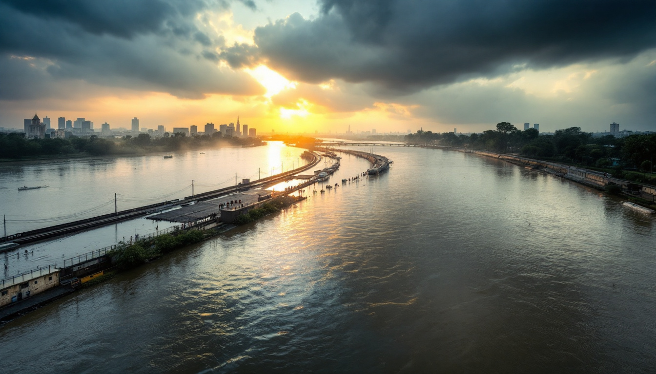
Yamuna flooding near Delhi forcing evacuations. Image created with AI.
Why 207 M Is a Critical Mark
You might wonder—why is the 207-meter level such a big deal? This number is more than just a height on a gauge. It reflects a boundary where river stress triggers urgent safety responses.
From an engineering standpoint, 207 meters signals the point at which embankments—and the city’s drainage systems—face extreme pressure. Infrastructure along the Yamuna, including bridges, pumping stations, and flood barriers, is designed to handle water levels comfortably below this height. Crossing 207 meters puts these structures on the brink of failure, increasing the risk of breaches or overflows.
Safety agencies treat this level as a tipping point for several reasons:
- Evacuation Triggers: Once waters near or pass 207 meters, authorities ramp up evacuation plans. Areas closest to the river require immediate clearing to protect residents.
- Infrastructure Strain: Pumping stations and sewer systems cannot handle the surge beyond this mark. This leads to flooded roads, malfunctioning drainage, and rising groundwater.
- Risk of Embankment Breach: Embankments designed for lower water levels are at risk of cracking or collapsing when pressure mounts.
Because of these factors, government agencies issue heightened alerts at this stage, moving from yellow to orange or red. The 207-meter level acts as a clear signal: action is needed now to safeguard lives and property.
The latest flood warnings and engineering background are detailed further by sources such as the Central Water Commission updates on Yamuna levels. Understanding this threshold helps make sense of why the current situation feels so urgent.
This historical backdrop shows us that when the Yamuna hits 207 meters, it’s a serious event with past lessons and future risks intertwined. Keeping a close eye on this number is key to protecting Delhi from flood disasters.
Impact on Delhi’s Infrastructure and Communities
The rising waters of the Yamuna have sent waves of disruption through Delhi’s infrastructure and deeply affected its communities. As the river climbs above 207 meters, areas once considered safe now find themselves battling encroaching floodwaters. Both daily life and essential services are strained, forcing a series of emergency measures. Let’s explore how this surge is disturbing key locations, starting with one of the city’s most significant cultural sites and stretching into the city’s vital transport and utility networks.
Nigambodh Ghat Inundation
Nigambodh Ghat, a centuries-old cremation ground along the Yamuna’s banks, now faces water lapping past its boundaries. Rising floods have seeped into the grounds where funeral rites continue, adding tension to an already grave situation. The ongoing cremation services have been impacted, with mourners and workers trying to manage ceremonies amidst swelling waters.
Municipal authorities are monitoring conditions closely. The Municipal Corporation of Delhi (MCD) is considering a temporary closure to prevent the risk to public safety. Pathways leading to the ghat have been submerged, and access has become limited because of waterlogging. While the rituals cannot simply pause, emergency measures prioritize safety first.
Nearby residential pockets also feel the pressure, with water creeping towards houses. The ghat’s inundation paints a stark visual of how far the floodwaters have advanced into Delhi’s heart, bringing a mix of cultural, social, and safety concerns.
Roads, Bridges, and Public Services
Delhi’s transport and public service networks have started to buckle under the rising water’s pressure. Many roads in flood-hit zones are either closed or at risk of closure. Municipal crews work overtime to sandbag vulnerable spots, trying to hold back water that inches closer to critical traffic arteries.
One of the major bridge closures includes the Old Railway Bridge (Loha Pul), a vital connection that has been shut to prevent accidents caused by rising river currents. This closure disrupts daily commutes and puts pressure on alternate routes.
Additionally, power outages have appeared in some flooded residential and commercial areas. Substations close to the Yamuna face saturation, causing temporary shutdowns that leave homes and businesses in the dark. Public transport services are also interrupted, with several bus routes rerouted or paused.
The city’s emergency teams coordinate to minimize the breakdown of services. Sandbagging continues at key points where water threatens to spill onto roads and enter neighborhoods. The danger to both people and infrastructure is very real and present.
For residents and commuters, this is more than inconvenience; it is a call to stay alert. These disruptions underline how the Yamuna’s rise affects the city’s muscles, from the sacred grounds at Nigambodh to the bridges and power grids keeping Delhi running.

Photo by Shantum Singh
For a daily update on flood impact and city management, sources like India Today’s flooding coverage provide useful insights.
Rescue Operations and NDRF Response
When the Yamuna crosses the 206-meter mark, flood response becomes urgent and precise. This stage is a tipping point where rescue operations swiftly ramp up to protect thousands at risk. The National Disaster Response Force (NDRF), along with local authorities, mobilizes teams, boats, and medical aid to move people to safety. Rescue centers fill quickly, and the city’s emergency services coordinate to cover the hardest-hit areas. Let’s explore how evacuations unfold and what challenges responders face in the thick of this flood crisis.
Evacuation Protocols
At 206 meters, the evacuation clock starts ticking. This threshold serves as the official trigger to begin moving residents away from the most vulnerable riverbank neighborhoods.
Authorities open multiple shelters positioned in safer, higher ground areas. Early reports show at least several relief camps activated in Yamuna Khadar and Mayur Vihar, some housing thousands of residents already displaced.
Resident notification happens through a mix of announcements:
- Loudspeakers and public address systems near affected zones broadcast evacuation orders.
- SMS and mobile alerts reach those with phones to guide timely departure.
- Volunteers and local officials go door-to-door to inform residents who may be less reachable by other means.
The rescue teams use rubber dinghies and inflatable boats to access submerged neighborhoods. Boats carry families from precarious upper floors and stranded locations out to relief sites. Rescue hubs run around the clock, with teams tracking evacuees and coordinating the next steps.
Each shelter is staffed with medical teams ready to provide triage, basic treatment, and hydration. Food and essentials are distributed promptly, and security is maintained to reassure anxious families. The structured approach keeps evacuees calm and helps prevent chaos.
This precise method of evacuation and shelter management relies heavily on close coordination between the NDRF, the Delhi government, and municipal authorities. The government’s preparedness to respond crisply at this 206-meter mark proves essential in limiting harm and disruption.
For further official details on how these shelters operate during floods, you can reference Delhi flood live updates and response.
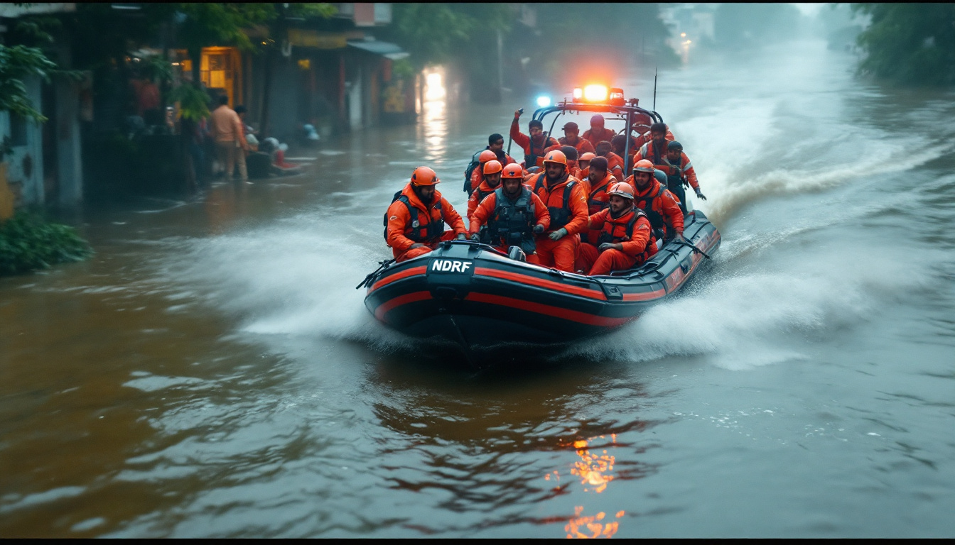
Image created with AI.
Challenges Faced by Responders
Flood rescue is far from straightforward. As the waters rise, responders confront numerous obstacles that test their skills and resolve.
Limited Access: Streets vanish beneath the water, making normal vehicles useless. Teams switch to boats or even ropes to reach trapped residents. Narrow lanes, submerged debris, and unpredictable currents complicate every step.
Rising Water and Fast Timing: Water levels don’t stay still. Surge after surge pushes responders to adjust plans on the fly, shifting rescue points and evacuation routes as areas flood unexpectedly. This urgency adds a tense rhythm to every call.
Medical Emergency Demands: Treating injured or sick evacuees on the move is tough. Medical teams operate crowded triage centers in temporary shelters or even on embankments. Supplies like medicines, clean water, and bandages must keep pace with growing demand.
Infrastructure Strains: Power outages disrupt communication and lighting, especially when night falls. Water supply interruptions force reliance on bottled water and portable sanitation units. Traffic jams on flood-affected roads further slow down the movement of emergency vehicles.
Despite these barriers, NDRF and local teams maintain steady progress. Their coordinated efforts save lives in challenging conditions. More than 10,000 people have already been evacuated, with rescue boats deployed in large numbers. Teams maintain contact through mobile command centers and work with police and health services to cover every corner efficiently.
This isolated battle against flooding is relentless—yet it highlights how trained teams, clear protocols, and determined responders make the difference between disaster and survival.
You can learn more about the scale and coordination of these rescue operations from recent news coverage: Heavy rains flood Delhi-NCR, NDRF steps up rescue.
Preparedness Measures and Future Outlook
As the Yamuna floods rise and Delhi faces the ongoing threat, preparedness is a blend of immediate action and long-term planning. Each decision today can save lives and reduce damage, but lasting peace with the river depends on well-thought-out strategies and coordinated efforts. The city’s emergency teams are active now, while officials also pitch ideas that could someday shield Delhi from these floods for good.
Short‑Term Actions by Authorities
In the critical next 48 hours, the priority is to protect people and property from immediate harm. Authorities on the ground are pushing into action with clear, hands-on steps aimed at flood control, rescue, and communication.
- Sandbag distribution is in full swing, with trucks delivering large quantities to vulnerable neighborhoods near the Yamuna embankments. These barriers help slow the water’s encroachment and prevent seepage into homes and key roads.
- Boat patrols cover flood-prone sections along the river, responding swiftly to stranded residents. Rescue teams and supplies mobilize constantly, making use of inflatable boats to navigate submerged streets.
- Public advisories come through loudspeakers, SMS alerts, and social media channels. These messages share vital details about safe evacuation routes, shelter locations, health precautions, and expectant weather changes.
These actions form a frontline shield, reducing chaos and buying time to save lives. Staying updated and following official guidance can make all the difference when water levels fluctuate unexpectedly. You can monitor real-time updates on relief and evacuation at Economic Times report on Yamuna breach and authorities’ response.
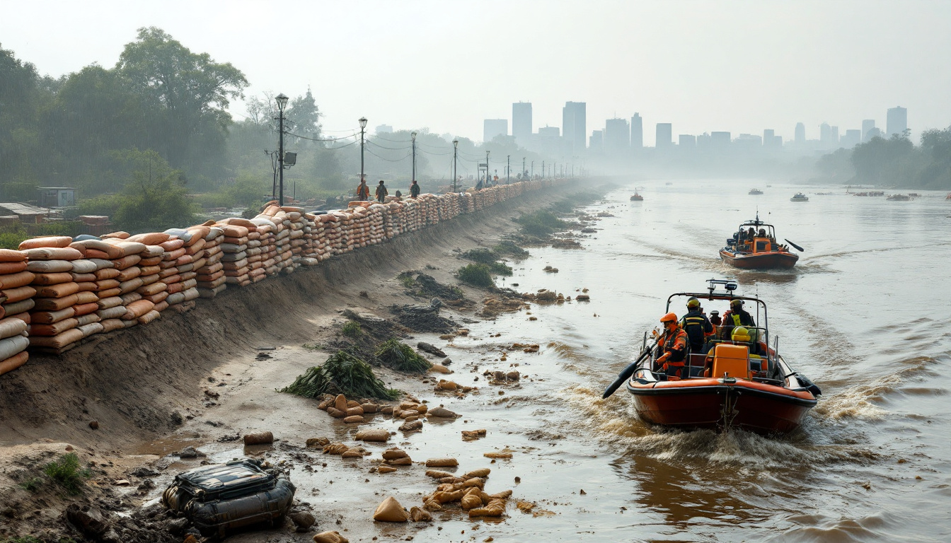
Image generated by AI.
Long‑Term Flood Mitigation Strategies
While urgent steps manage today’s crisis, Delhi’s future depends on stronger defenses and smarter planning. The city’s long-term strategy focuses on reducing flood risk through infrastructure upgrades and sustainable city design.
- Embankment construction and reinforcement remain a top priority. Building higher and sturdier riverbanks can prevent breaches when water surges past historic levels. These technical works also improve the city’s flood warning and drainage capabilities.
- Upstream flow regulation calls for better coordination with states along the river. Controlled release of dam reservoirs and well-planned catchment management can reduce the flood volumes arriving at Delhi. Timely water management upstream helps ease pressure downstream.
- Climate-resilient urban planning designs neighborhoods to absorb and handle heavy rain. This includes more permeable pavements, expanded green areas to soak excess water, and construction standards that require flood-safe features. Future housing and roads should fit the environment’s flood patterns instead of fighting them.
This long view demands consistent funding, cross-state cooperation, and community involvement. Flood warning systems must improve, using data and technology that give residents plenty of time to act safely.
For further context on these initiatives and government efforts, check detailed updates at Central Water Commission’s Yamuna river management page.
Building flood resilience is about blending engineering with community readiness. Residents can bolster safety by maintaining emergency kits, staying informed on weather and flood warnings, and practicing evacuation drills. Preparedness at all levels—from government to household—is the strongest defense against floods.
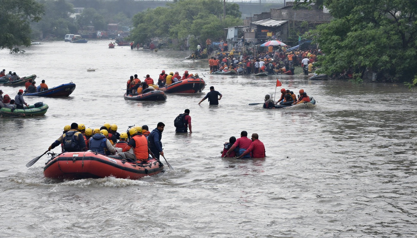
Image generated by AI.
Conclusion
The Yamuna crossing the 207-meter mark in 2025 signals a serious flood threat for Delhi, putting the city on yellow alert and forcing thousands to evacuate. This surge highlights not just rising water levels but the urgent need for vigilance and quick response. Alerts from the IMD and CWC guide crucial safety steps, reminding residents near the river to stay informed and follow official advice closely.
As water levels edge higher, disruptions to daily life and infrastructure intensify, underscoring the importance of preparedness. The collective effort of rescue teams, authorities, and communities aims to reduce harm, but staying safe depends on everyone’s awareness and action. Keep monitoring official updates, respect evacuation orders, and prioritize safety as the situation develops. Your readiness can make all the difference when nature tests the city’s limits again.